Make: Pentax; South
Model: G6Ni; Galaxy G4
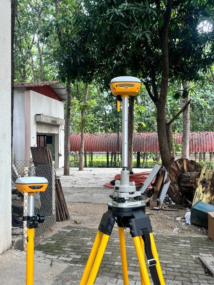
- Horizontal and Vertical accuracy 2.5mm and 3mm respectively.
- Relatively less RTK initialization time as in 2 to 10secs.
- Built-in IMU module, calibration-free and immune to magnetic interference.
- Capable to gather extremely precise data on topography, land features etc.
- Establishing precise property boundaries and creating topographic maps.
Room No.:G05 CTS building- ground floor,
Surveying LAB, School of Civil Engineering,
Vellore Institute of Technology (VIT), Vellore.
Surveying LAB, School of Civil Engineering,
Vellore Institute of Technology (VIT), Vellore.
Dr. L. Vignesh Rajkumar,
Assistant Professor Senior
Department of Environmental and Water Resources Engineering,
Vellore Institute of Technology (VIT), Vellore - 632 014, Tamil Nadu, India.
Email: vigneshrajkumar.l@vit.ac.in || Mobile: +91 9566051611
Instrument email ID: sce.dgps@vit.ac.in
Assistant Professor Senior
Department of Environmental and Water Resources Engineering,
Vellore Institute of Technology (VIT), Vellore - 632 014, Tamil Nadu, India.
Email: vigneshrajkumar.l@vit.ac.in || Mobile: +91 9566051611
Instrument email ID: sce.dgps@vit.ac.in
Charges: Charges are subjected to change based on the visual inspection and nature of the work.
* Charges for per job in INR (+ applicable GST)
| S. No. | Equipment Details | UG /PG Students from Academic Institutions (in INR) | Research Scholar from Academic Institution (in INR) | Project Staff from Academic Institution (in INR) | Faculty Members from Academic Institutions (in INR) | Research Scientist from R&D Organizations (in INR) | Industry Personnel from Industry (in INR) |
|---|---|---|---|---|---|---|---|
| 1 | DGPS(unknown point) | 1500/pt | 1500/pt | 1500/pt | 1500/pt | 2000/pt | 2000/pt |
| 2 | DGPS(known point) | 1000/pt | 1000/pt | 1000/pt | 1000/pt | 1000/pt | 1000/pt |
* Charges for per job in INR (+ applicable GST)