Make: Aviocian
Model: Avio M1
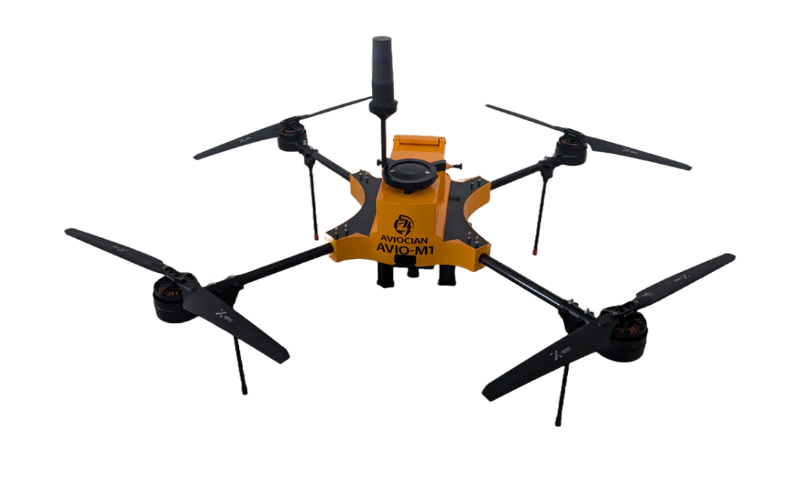
- High-resolution geotagged imagery with centimetre-level accuracy using RTK/PPK GNSS integration
- High-resolution photos can be used for mapping and surveying.
- Capable flying continuously for 20 mins on single charge.
- The entire flight route and schedule can be fully pre programmed
Room No.:G05 CTS building- ground floor,
Surveying LAB, School of Civil Engineering,
Vellore Institute of Technology (VIT), Vellore.
Surveying LAB, School of Civil Engineering,
Vellore Institute of Technology (VIT), Vellore.
Dr. L. Vignesh Rajkumar,
Assistant Professor Senior
Department of Environmental and Water Resources Engineering,
Vellore Institute of Technology (VIT), Vellore - 632 014, Tamil Nadu, India.
Email: vigneshrajkumar.l@vit.ac.in || Mobile: +91 9566051611
Instrument email ID: sce.drone@vit.ac.in
Assistant Professor Senior
Department of Environmental and Water Resources Engineering,
Vellore Institute of Technology (VIT), Vellore - 632 014, Tamil Nadu, India.
Email: vigneshrajkumar.l@vit.ac.in || Mobile: +91 9566051611
Instrument email ID: sce.drone@vit.ac.in
Chares are subjected to change based on the visual inspection and nature of the work.
* Charges for per job in INR (+ applicable GST)
| S. No. | Equipment Details | UG /PG Students from Academic Institutions (in INR) | Research Scholar from Academic Institution (in INR) | Project Staff from Academic Institution (in INR) | Faculty Members from Academic Institutions (in INR) | Research Scientist from R&D Organizations (in INR) | Industry Personnel from Industry (in INR) |
|---|---|---|---|---|---|---|---|
| 1 | Aerial Mapping | 1500/acre | 1500/acre | 1500/acre | 1500/acre | 2000/acre | 2000/acre |
| 2 | Topographic survey | 3500/acre | 3500/acre | 3500/acre | 3500/acre | 4000/acre | 4000/acre |
* Charges for per job in INR (+ applicable GST)