Make: Leica
Model: BLK360
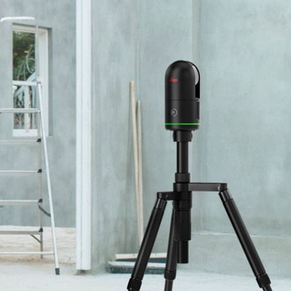
- Ultra-Fast Scanning in 2 mins and high-speed data transfer.
- Capturing as-built conditions for property documentation.
- High-accuracy data collection for site surveys and measurements.
- Capable to generate point cloud information as 3D model of terrestrial features.
- At the recommended scanning distance of 10m, the BLK360 has 6mm accuracy
Room No.:G05 CTS building- ground floor,
Surveying LAB, School of Civil Engineering,
Vellore Institute of Technology (VIT), Vellore.
Surveying LAB, School of Civil Engineering,
Vellore Institute of Technology (VIT), Vellore.
Dr. L. Vignesh Rajkumar,
Assistant Professor Senior
Department of Environmental and Water Resources Engineering,
Vellore Institute of Technology (VIT), Vellore - 632 014, Tamil Nadu, India.
Email: vigneshrajkumar.l@vit.ac.in || Mobile: +91 9566051611
Instrument email ID: sce.lidar@vit.ac.in
Assistant Professor Senior
Department of Environmental and Water Resources Engineering,
Vellore Institute of Technology (VIT), Vellore - 632 014, Tamil Nadu, India.
Email: vigneshrajkumar.l@vit.ac.in || Mobile: +91 9566051611
Instrument email ID: sce.lidar@vit.ac.in
Chares are subjected to change based on the visual inspection and nature of the work. (Maximum 10 scans/day)
* Charges for per job in INR (+ applicable GST)
| S. No. | Equipment Details | UG /PG Students from Academic Institutions (in INR) | Research Scholar from Academic Institution (in INR) | Project Staff from Academic Institution (in INR) | Faculty Members from Academic Institutions (in INR) | Research Scientist from R&D Organizations (in INR) | Industry Personnel from Industry (in INR) |
|---|---|---|---|---|---|---|---|
| 1 | LiDAR Scan (raw point cloud data) | 5000/day | 5000/day | 5000/day | 5000/day | 6000/day | 6000/day |
| 2 | Stitched Scans | 8500/day | 8500/day | 8500/day | 8500/day | 10000/day | 10000/day |
* Charges for per job in INR (+ applicable GST)